hale»connect 1.9.0: Explore INSPIRE data sets like you've never seen them before, Dataset Attachments and Metadata Re-Use


We have now changed our release cycles so that hale»studio and hale»connect releases happen in quick succession - first hale studio, then hale connect. In this way we ensure that all capabilities you can use in hale studio also work in hale connect. This latest version of hale connect has been rolled out to all public cloud and private cloud instances and includes the following updates:
- Support for external datasets metadata sources such as Catalogue Services or Portals
- Support for dataset attachments (such as PDFs, Textures and GeoTIFFs or other Raster data sets)
- A New GetFeatureInfo client in the WMS map preview
- A New Feature Explorer Tool specifically designed for object-oriented and linked data
To try out the new features, head over to www.haleconnect.com and either log in with your existing account or create a new (30-day trial) account.
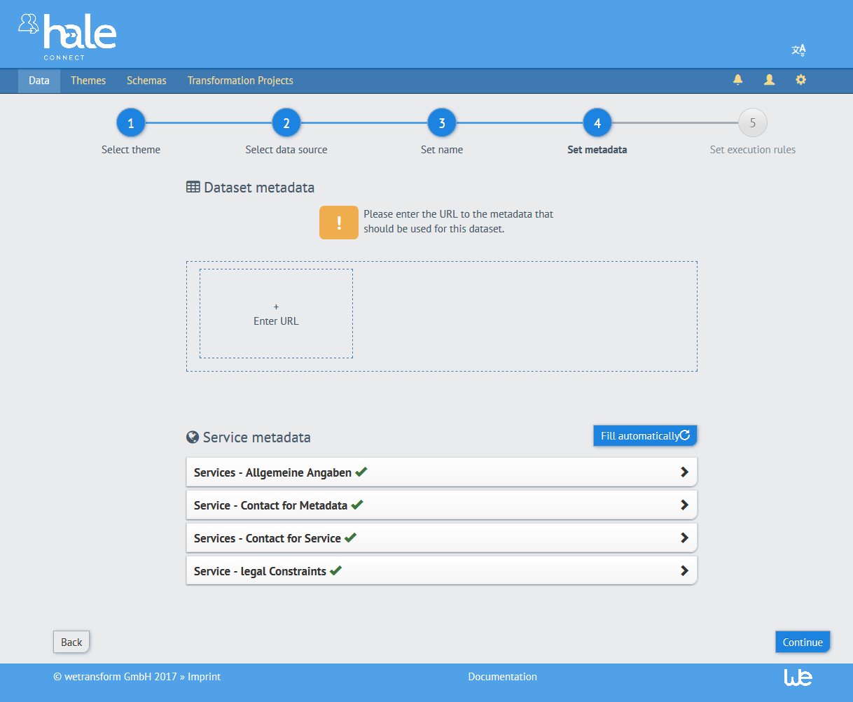
Support for external metadata sources
hale connect now supports the direct re-use of your existing metadata files. For theme managers, these options are configurable in the metadata section of your theme:
- Select ‘Republish existing metadata’ to upload your XML or XSD during data set creation
- Select ‘Link to existing metadata’ to provide a URL pointing to dataset metadata
This option you have selected appears in the metadata step of dataset creation. More information on metadata workflows is available from a recent tutorial.
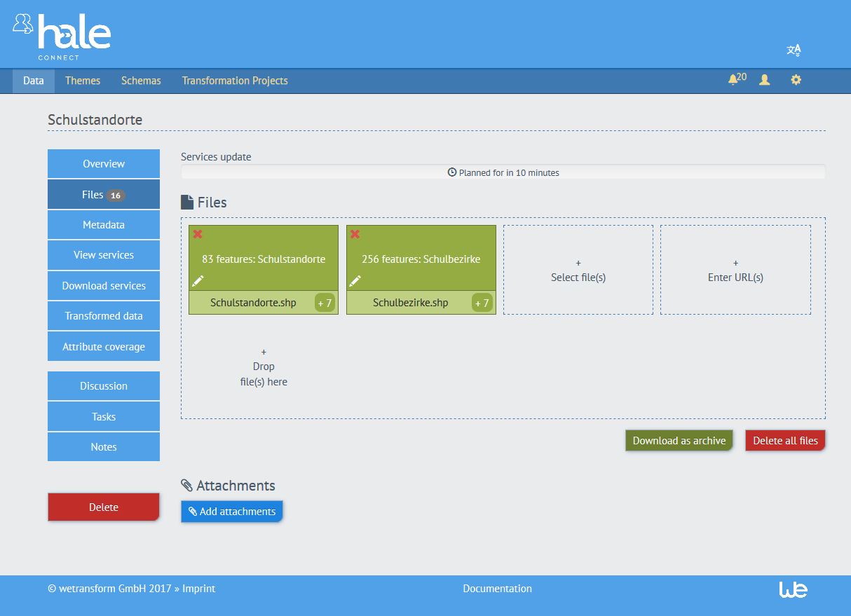
Support for dataset attachments
hale connect 1.9.0 makes it possible to reference file attachments from uploaded or transformed data sets.
To upload attachments, navigate to the Files section of your data set and click the ‘Upload attachments’ button.
To reference the uploaded attachments, your GML source data needs to include the following expression as the value for the attribute which references the attachment: attachment:///<filename>. The filename of the attachment must be identical to the filename in the GML. When the dataset is published, the expression is transformed into a publicly available link to the uploaded attachment file.
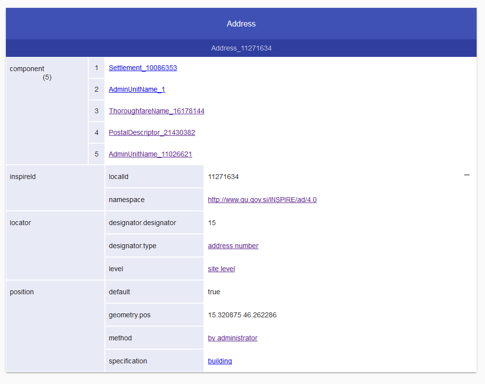
New Feature Explorer Tool: includes support for links to related features
Much Linked Data, as well as Open Standards Data, uses rich object-oriented models, with many explicit and implicit references between objects (or as the GIS community calls them, features). Such references are hard to navigate and use in a classical, layers-based GIS. We have thus developed a specific client to explore such data sets.
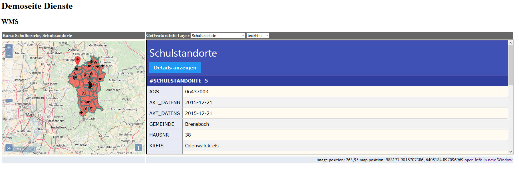
The Feature Explorer can be accessed via the GetFeatureInfo client on the WMS map preview for your published view services. The Feature Explorer can be used to explore GML that contains complex features and links to related features. INSPIRE compliant GML often contains links to related features, or codelists, which provide additional information about the feature.
To access the Feature Explorer, click on the ‘show Details’ button in the HTML view of GetFeatureInfo client. The Feature Explorer opens in a new tab which displays the attributes associated with the selected feature. Click on any link to further explore the attributes or related features. A ‘+’ button appears to the right of attributes which contain additional levels of nesting.
GetFeatureInfo added to WMS Map Preview
GetFeatureInfo is an optional operation which allows users of your view services to query your WMS layers. The GetFeatureInfo client is only available for WMS layers which have been configured to support the GetFeatureInfo operation.
As a theme manager, you can activate GetFeatureInfo for your WMS in the View Services sections of the associated theme. To access the GetFeatureInfo client, click the Map view link in the View Services section of your dataset. Click on any feature in the map preview to view attributes for the selected feature. The GetFeatureInfo client allows you to select the feature layer you are viewing and the display format (HTML, plain text or XML).